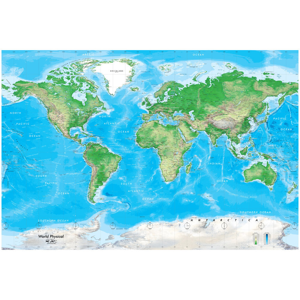

An aesthetically stunning physical map of the world featuring detailed political data that is up-to-date for 2014. The map blends colorful hypsometric tints with 3-D shaded relief. In addition to bands of elevation shading the map features ocean bathymetry. A wide range of geographic information identifies cultural and physical features including: Country & U.S. state boundaries outlined, all countries labeled including island nations. Major cites, national capitals, U.S. & Canadian capital cities. Rivers, lakes, mountain ranges & peaks, deserts. Geologic basins. Major seas, bays, and straits. Major and minor islands. Ocean floor details including: fracture zones, ridges, and trenches. Latitude/longitude, international dateline, and time zones. Topographic shading and ocean bathymetry. Detailed shaded relief. Elevation and sea depth color legend. This colorful world wall mural map will surely attract attention in your home, office, public lobby, or classroom. Map utilizes shaded relief based on NASA SRTM elevation data. A Miller projection is used for this map. We offer this map in numerous sizes printed on an easy to install peel and stick fabric. The self-adhesive peel and stick fabric is resistant to water, wrinkles, bubbling and tears. Unlike traditional wallpaper murals, this fabric goes up without causing any damage to the wall and will leave no residue. Since the fabric is repositionable you can simply peel it off and transfer it to another location. Ideal for commercial or residential installation.
Related products

Uncategorized

Uncategorized
Uncategorized

Uncategorized